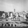
The Map Forma Ubris Romae is archaeologist Rodolfo Lanciani’s interpretation of Rome in the beginning of the 20th century. The map is made up of 46 plates containing information from multiple maps before Lanciani containing the information of ancient ruins within the city. For the past 7 years, our team has been breaking down the layers of information into sub-layers based on time period, color interruptions, and landscape. The pictures presented are a break down of the work we have so far.


Mapping Rome